5/24/14
It is Saturday. The campground is full, and we suspect most every park for miles is too. It is Memorial Day weekend. Most places have been preparing to open today, for weeks. Our trip will change after today, but we are ready. We have been making plans since December, so that we would be ready for the 'summer onslaught' of families on vacation. We have all of our camping reservations made through Labor Day. At least the bathrooms will be unlocked next week, that is the bright side.
We are enjoying the day, here at the motor home. We have been on the road for 51 days...some not so nice days, other days you could describe as perfect Spring days. It is going to get like summer soon, so we need to enjoy days like this.
We are glad to share our trip with you all. This will also serve as a record of what we did and what we have seen. I hope you enjoy following along...life is not always this much fun.
Steve & Barb Larson
Saturday, May 24, 2014
5/23/14
We decided to take a break, enjoy a beautiful day at the lake, do some planning, and relax a bit. I sat at the picnic table overlooking Flathead Lake, in the shade, and enjoyed the day & the view, while Barb read a book. I also planned our trips for next week. We are moving 2 hours south on Tuesday. The weekend mob started moving in later in the afternoon, which is always a source of entertainment. Lots of equipment that isn't very well cared for, 6 bikes strapped on the back, and kids with their first chance to go swimming (I checked, the water is 54 degrees...brrr). I also made a grocery run, which was also entertaining, lots of folks stocking up for the 3 day weekend.
But the highlight of the day? My sister Peggy went home from the hospital after a 10 day stay that was very touch & go. I called her and talked to her for about 10 minutes. What a miracle. We are so happy she made it through this crisis, but are also well aware that the next one could be the last one, which would be very sad. We continue to get further away, so that makes for a lot of consternation. We hope all goes well in the near future.
We BBQ'd steaks on the grill to end our day. We have lots of fun stuff planned, so stay tuned...
Steve & Barb Larson
5/22/14
We got up at 7, had some breakfast, and were gone by 730. Our drive north from Browning would have been extremely bland if not for the beautiful mountains to the west, a combination of Glacier & Waterton Parks. All are snow capped and very rugged. We arrived at the border at the Chief Mountain checkpoint just before 9 am (opening time) and sat at the road block and watched the RCMP (mounties) & US Border Patrol do their ceremonial gate opening. It was almost humorous...a female BP had the keys to both gates, she opened the US gate first and then handed the key to one of the Mounties, who opened the other gate and handed the key back to the other US agent. The whole time they were all chuckling & smiling like 'let's make this look good for these tourists from Florida'...sort of hoky. But we passed through customs with no issues and were on our way. One thing we noticed, the road on the US side was much better than on the Canadian side...but they have free health insurance...lol. That is a little chuckle from last summer...a US border patrol told us that answer when I asked about the difference in gas prices...they pay more for gas but they have free health insurance...lol.
We proceeded to Waterton Lakes and went straight to the marina to inquire about a lake cruise on Upper Waterton Lake, which travels the length of the lake to Goat Haunt in Glacier...one boat ride, two countries. We found out they only had 5 passengers, including us, and the minimum was 8, so we needed to wait to see if anyone else showed up...it was a beautiful morning, so we waited. About 15 minutes later, another couple showed up, so the 7 of us and 2 crew set sail on a 2 hour cruise...a twooo hour cruise...sounds like Gilligan's Island.
We spent the next 2 hours following the shoreline of the lake south to Goat Haunt and back, crossing the Canada/US border twice, marvelling at the beautiful scenery and watching for wildlife. What a pretty ride! The whole time, Gilligan, I mean the mate, gave us a running dialouge over a not so good PA system, telling us what we were seeing. The water was sparkling, the sky clear and the mountains gorgeous, so it was worth the trip. With only 7 passengers, it was almost like a personnal tour, so it was a nice way to spend 2 hours.
After we got back, we took a drive along Red Rock Parkway (the only road open in Waterton Lakes) which ends at Red Rock Canyon. We then set sail out of Waterton Lakes north, which took us through Pincher Creek, Alberta and then west into British Columbia, crossing the Continental Divide again, through Sparwood, BC (home of the worlds biggest truck) and south through Roosville and back into the US (the US BP at least looked in our back seat) and realizing that all the jackets were probably normal for 2 Floridians, so he said, Thank You, have a nice day, and we were on our way. US 93 is a pretty road, passing trough the Flathead National Forest, Whitefish, and into Kalispell. We stopped in Woods Bay for dinner and had a nice meal looking out at a very calm Flathead Lake. We got back home just in time to watch the sunset over the lake from our backyard. It was a very nice way to end the 2nd day of a very beautiful trip.
Steve & Barb Larson
 |
| Where the prairie meets the mountains |
 |
| Chief Mountain near the Canada/US Border |
 |
| At the border |
 |
| In Waterton Lakes National Park |
 |
| All of the next pictures were taken on our cruise from the boat |
 |
| The US/Canada border goes out of sight |
 |
| Gorgeous scenery |
 |
| We survived our twooo hour tour |
 |
| Big Horns trotting down the road |
 |
| At Red Rock Canyon |
 |
| Going back over the Continental Divide between Alberta & BC |
 |
| Worlds biggest truck in Sparwood, BC |
 |
| Back in the USA |
 |
| The view of Flathead Lake when we were eating dinner |
 |
| The sunset on Flathead Lake when we got back to our camper |
5/21/14
We are off early again, headed to a two day trip to see Glacier and Waterton Lakes National Parks. A lot of the roads we will travel for the next 2 days will be the same roads I traveled in 2005 while I was on a motorcycle ride. For those of you who don't know, in July 2005, I flew to Boise, ID, rented a Harley, and spent the next 7 days riding 3411 miles from Boise to Jasper, back down through Banff, Glacier, Helena, Yellowstone, Jackson,WY, Salt Lake, Stanley, ID, Unity & Baker City, OR & back to Boise...what a trip! Now, I want Barbara to see some of the very beautiful and very cool sights I saw on that trip.
We already know that Glacier is mostly closed because of an unusual snow pack through the park. We drove north from Finley Point to Hungry Horse, which included a side trip to the Hungry Horse Dam, and also a stop at the Berry Patch, where everything is Huckleberry, including the milk shakes...very yummy. Then we went into Glacier, where only the first 15 miles of Going to the Sun road are open. We stopped to take pictures on Lake McDonald, Avalanche River's many rapids and a hike along the Trails of the Cedar near Avalanche Creek at the place the road is closed. On the way back out, we stopped at the Apgar Visitor's Center for info on the rest of our trip...those folks at those visitor centers are so helpful.
We then turned east on US 2, which follows the Middle Fork of the Flathead River, what a pretty ride. Going over the Continental Divide is especially cool, you can actually see the water flowing both directions in a short distance. Going down the east side takes you through the Lewis & Clark & Flathead National Forests...very pretty ride. We continued on US 2 past East Glacier to Browning, MT and got us a room for the night at a Holiday Inn. It is really the only decent hotel in town. We are just happy for a clean bed & a place to get a shower. Tomorrow is another day...a welcome good night's sleep is ahead.
 |
| Huckleberry milk shake...yep, very tasty |
 |
| Lake McDonald |
 |
| Trail of the Cedars |
 |
| Our chauffeur extrordinaire |
 |
| Avalanche Creek rushing into Lk. McDonald |
 |
| At the Continental Divide on US 2 |
 |
| The Continental Divide markers |
 |
| Where the mountains meets the prairie |
 |
| Looking into Glacier from the south...on US 2 |
 |
| Barbara having a good time |
 |
| Lots of snow melting |
 |
| Beautiful view beyond Lk McDonald |
 |
| Lots of snow up on the mountain |
5/20/14
We are up early & off to explore NW Montana. Our day began with a visit to the National Bison Range near Moiese, MT near the intersection of US 93 & MT 200. As you can imagine, wildlife everywhere. Bison, pronghorn sheep, deer, and lots of birds that we saw and elk, moose & bear that we didn't see. The location is a beautiful valley with a pretty big mountain in the center, nice vistas of the valley. We spent a couple of hours driving the main loop...pretty way to start a day. You can see a long way from the top of the mountain.
We stopped at the Visitors Center (not open yet when we arrived) and then headed NW on MT 200, which follows the Clark Fork River on its way to meeting up eventually with the Columbia in Washington on its way to the Pacific. It joins the Thompson River near Thompson Falls and continues NW into Idaho. We stopped in Trout Creek (Huckleberry Capital of Montana) for lunch, where they were preparing for a professional bass fishing tournament, lots of expensive Bass boats in town. After lunch, surrounded by lots of dead animals on the walls, we continued on to MT 56 with a stop at the Noxon Rapids Dam, a hydroelectric dam that controls the river plus creates a lot of electricity, and creates smooth waters for bass boats.
Upon arrival at US 2, we turned back east, first stop is the Kootenai Falls, which required about a 2 mile hike through the woods, over the railroad tracks, and along the Kootenai River, which also flows into Idaho & British Columbia where it joins the Columbia. We were on our way east, passing through Libby for a visit of the Libby Dam, another huge hydroelectric facility and a reservoir that goes all the way to British Columbia...beautiful spot. These dams are an important part of keeping the rivers from flooding when the snow melts in the mountains, etc.
We then went back through Libby and followed US 2 back to Kaliispell and back to Finley Point & our camper. US 2 is a very scenic ride, lots of rivers to cross, hills to climb, a lot of mountains, and a gazillion trees. We got back about 930, a 13 hour ride, but we saw a lot of interesting things along the way...fun day. We enjoyed beautiful weather to go with beautiful scenery. We almost made to both Idaho & BC, Can.
 |
| Ringneck phesant...reminded us of Barb's dad |
 |
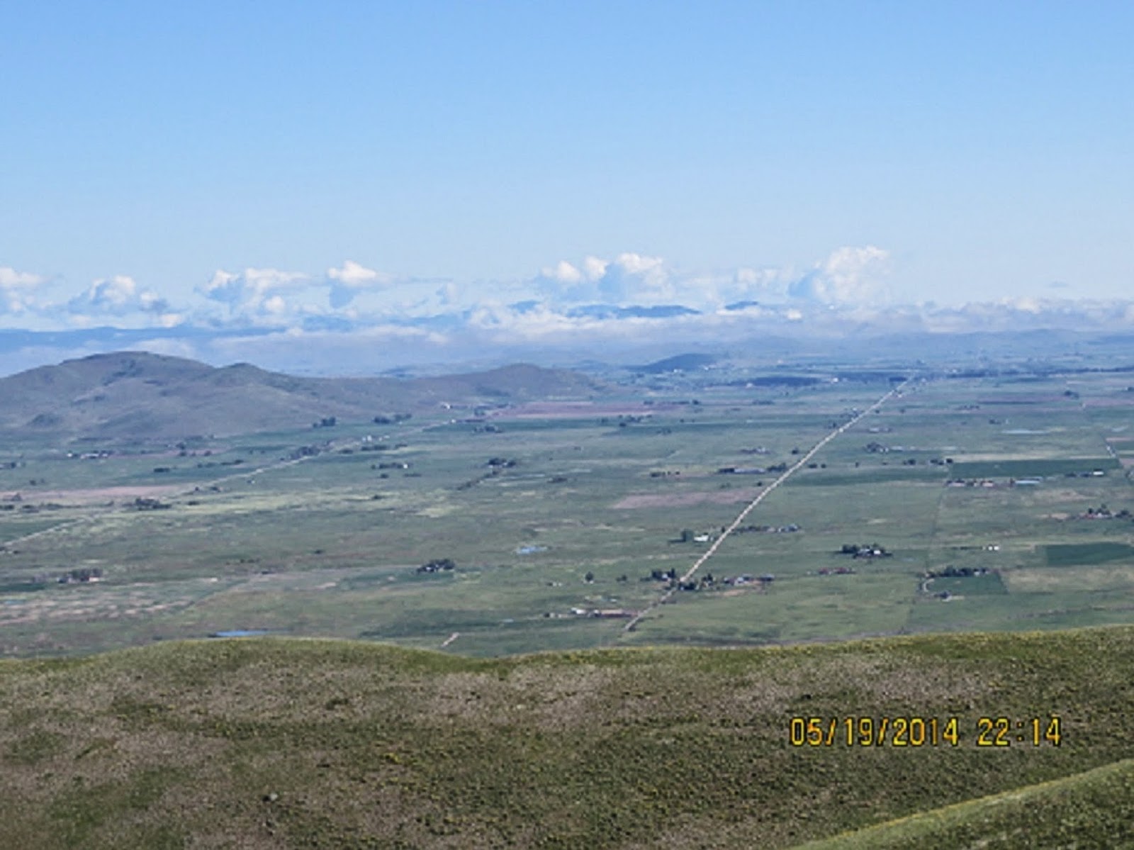
| Some views from on top of the mountain |
 |
| Pronghorns |
 |
| Noxon Rapids Dam |
 |
| Kootenai Falls |
 |
| Kootenai Falls |
 |
| Libby Dam |
 |
| Libby Dam |
 |
| Flathead Lake just after sundown |
Subscribe to:
Posts (Atom)